Mungalla: Healing the Herbert
Owners of Mungalla in the Herbert catchment are helping bring wetlands back to life
Healthy waterways underpin our lifestyles and livelihoods. When waterways thrive, so do we.
Cyclone Jasper’s flooding rain smashed records – and suburbs and towns. While flooding is a natural phenomenon in the Wet Tropics, a bigger flood event like this one is a taste of what might be in store for us in coming years.
The heavy rains that followed Cyclone Jasper were a stark reminder of a changing climate’s potential impacts. Extreme rainfall and floods are becoming more frequent as the average global temperature rises.
Climate scientist Dr. Steve Turton says that for every temperature increase of one degree centigrade the atmosphere can hold an extra seven per cent of water vapour, and when the conditions are right it is released as intense rainfall.
“Last year was the warmest year on record and sea surface temperatures were record breaking every single day. Then along comes Cyclone Jasper and instead of moving away and taking the rain with it, the system remained stationery, bringing down moist air down and causing several days of torrential rain,” he says.
The water levels in the lower Barron River after Cyclone Jasper smashed a 41-year-old record, and in the Daintree River a 2019 record was broken by more than two metres. It caused huge landslides, punched a new river mouth into the coastline and caused major damage to homes and infrastructure.
Dr Han She Lim, a hydrology researcher at James Cook University, said the Barron River flood caught everyone by surprise.
“Cyclone Jasper itself didn’t cause too much damage but it was the rainfall after it passed that caused the damage. Nobody was expecting the flood that came afterwards,” she says.
“We live in an area that is prone to flooding and the more we build on flood plains, the greater our exposure to risk of flooding. While flood modelling and mapping has highlighted the areas that are most at risk, this flood reiterated that we can never be 100 per cent certain about where and what the impacts of floods will be.
“In this event, some areas were flooded that we didn’t expect, with one area affected by rocks and debris that washed downhill and blocked drains,” she says.
“But then on the other hand, there were areas that we would expect to be a higher flood risk, that didn’t flood. So, the key message is to know your flood risk by checking out your local council’s flood maps – but also to be prepared for the unexpected.
“As a community we did a really good job at rescue and recovery after the floods. The SES were efficient, and volunteers stepped up to help those affected. But many people – from newcomers to longtime locals – were not sure how to prepare or when to evacuate so we need to raise community awareness, just as we do for cyclones.”
Extreme events aside, Dr Richard Hunt from Wet Tropics Waterways says floods are a natural – and important – part of our region’s ecology.
“For most of the last eight to nine years, we’ve seen below average rainfall in the Wet Tropics,’’ he says. “But floods are important for connecting aquatic habitats, replenishing flood plains and wetlands, recharging groundwater supplies, dispersing and germinating seeds and helping cycle nutrients and sediments.”
“Many fish, birds and other wildlife also rely on high-flow events to trigger lifecycle events. For example, there is evidence that populations of fish species like barramundi often increase in response to floods.”
Flood Checklist
Prepare for flooding, including having an emergency household plan. (See your local council’s website).
Know your flood types

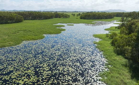
Owners of Mungalla in the Herbert catchment are helping bring wetlands back to life


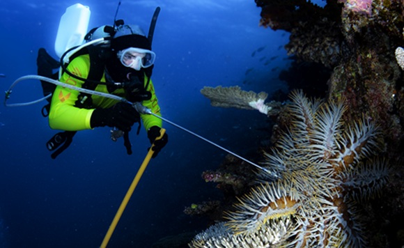
Marine biologist Rickard Abom shares his experiences of the Great Barrier Reef

Martine joined the Wet Tropics Waterways team as a Science Technical Officer in early 2024. She is an environmental scientist and ecologist and has worked on water quality and aquatic ecology projects as a consultant and in private industry for over 20 years. She is using her experience in statistical programming and database development to develop new systems for the Report Card.

Louise joined Wet Tropics Waterways as Executive Officer in 2025.
Louise Hateley is an environmental scientist with over 20 years of experience in natural resource management, water quality, and catchment modelling across government, research, and community sectors. She has held senior scientific and project coordination roles with the Department of Natural Resources, Mines and Energy and Terrain NRM, leading projects focused on GBR catchment health, waterway management, and sustainable land use. With a record of published research, stakeholder engagement, and project delivery, Louise combines scientific expertise with practical leadership to drive initiatives that protect the Wet Tropics and support community collaboration.

Simon has over 30 years’ experience advocating for waterways across academia, government and the private sector. He started out in marine botany with a fascination for seagrass, mangroves and macroalgae, and has gone on to lead major environmental initiatives both in Australia and overseas. He has established report cards in eight countries.

Richard has been the Science Technical Officer for Wet Tropics Waterways since 2016. His role involves producing the annual results for the waterway health assessment of the wet tropics region using data from a wide range of sources, to present as scores and grades, as well as developing new indicators to address knowledge and monitoring gaps. He works in collaboration with technical staff at other regional report cards.
Richard has a background in freshwater ecology research projects and environmental assessments with CSIRO, University of Queensland, Queensland Government and as a consultant. For a long time he’s been interested in freshwater aquaculture and continues this interest through farming freshwater crayfish, alongside other farming activities.