our region.
The boundary of the Wet Tropics region follows the edge of nine catchments. Each catchment collects and redirects water across the landscape through many thousands of waterways before draining into the Great Barrier Reef lagoon.


at a glance.
The Wet Tropics NRM region covers a land area of 21,722 km2 and supports a residential population of close to 250,000 people.
Land use in the region is dominated by nature conservation and agriculture. As well as the agricultural sector, important regional industries include marine and land-based tourism, commercial and recreational fisheries, and aquaculture.
The region’s tropical climate is characterised by higher rainfall and temperatures during the summer wet season, which is dominated by major events such as rain depressions, monsoons and cyclones.
The Wet Tropics is the wettest of the Great Barrier Reef regions with annual rainfall averaging 1,580 mm. Rainfall is highly variable geographically and between years.
High relief mountains are located close to the coast and form a narrow coastal plain. These features, when combined with high rainfall events result in large river discharges and high streamflow velocities.
Approximate annual rainfall ranges are between 500–4,500 mm and follow an east to west gradient with the highest at the coastal fringes (averaging 3,000 mm annually) and lowest at the region’s most westerly boundary (averaging 500 mm annually).
The nine river catchments of the Wet Tropics are the Daintree, Mossman, Barron, Russell, Mulgrave, Johnstone, Tully, Murray and the Herbert.
what do we know about our catchments?
During 2016-18 the Queensland Government and Terrain NRM rolled out a program to harness local and scientific information about our nine catchments.
The Walking the Landscape program is a systematic and scientific framework for developing a ‘whole-of-landscape’ understanding of a catchment to help make improved decisions about the management and restoration of ecological systems. It was developed by the Queensland Wetlands Program through the Department of Environment and Science.
The information gathered during this process is being used to help develop new projects.
More than 200 people took part in the process of integrating existing data, maps and reports with the expert knowledge of locals. The workshops included scientists, technical experts, farmers, landholders, community groups and industry groups.
All of the information gathered from the Walking the Landscape workshops has been captured in catchment profile storymaps that are publicly available on the Wet Tropics Plan for People & Country website.
Take an interactive journey through each catchment:
Barron catchment | Daintree catchment | Herbert catchment | Johnstone catchment | Mossman catchment | Mulgrave catchment | Murray catchment | Russell catchment | Tully catchment

ecosystem services.
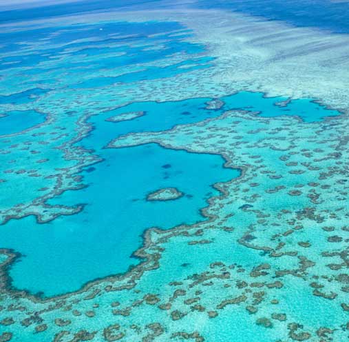
Our waterways represent enormous economic value (with the Great Barrier Reef alone estimated to be worth $54 billion), as well as things that are just as valuable – but intangible and far more difficult to put a price on.
‘Ecosystem services’ are things that make life possible or provide a benefit to our wellbeing. Waterways don’t just provide us with swimming holes to cool off in, they provide things we couldn’t get by without.
For example, when we think about waterways we might think about the physical things they provide us with like drinking water, but they also provide non-tangible values like aesthetic beauty and benefits to mental health. A number of studies have shown links between exposure to ‘blue spaces’ such as rivers and beaches, and improvements in wellbeing. Spending time in and around aquatic environments has been shown to be more effective at regulating moods and reducing stress than green space!
Different types of waterways provide different ecosystem services, and these can be divided into four categories:
- provisioning services (fisheries, building materials)
- supporting services (life-cycle maintenance for both fauna and local, element and nutrient cycling)
- regulating services (carbon sequestration and storage, erosion prevention, waste-water treatment, moderation of extreme events)
- cultural services (tourism, recreational, aesthetic, and spiritual benefits)


rivers and streams.
Drainage networks that weave across the landscape transporting water and sustaining a diversity of ecosystems, rivers and streams provide fresh water for humans, livestock and agriculture; nursery grounds for many commercially, recreationally and culturally important fish species; a diverse range of recreational activities; and drainage and flood buffering.
wetlands.
Affectionately known as earth’s kidneys, wetlands filter water as it passes through the landscape and provide: carbon sequestration; nutrient cycling; protection of coastal communities from floods, storm surges and cyclones; habitat for rare and threatened species, particularly migratory shorebirds; nursery grounds for many commercially, recreationally and culturally important fish species.
estuaries.
Estuaries are the interface between the fresh and saltwater worlds. They are the mudflats, mangroves and saltmarsh that can be found along our coastlines. Estuaries provide us with: nursery grounds for many commercially, recreationally and culturally important fish species; filtration of nutrients, sediments, and pesticides from water; protection of coastal communities from floods, storm surges and cyclones.
marine.
Our seas, oceans and beaches are at the heart of many of our coastal communities. More than just a place to spend our summers, marine waterways provide critical services to humans including temperature regulation and carbon sequestration.